
 stock photo.")
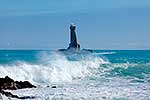
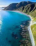
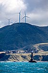
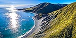
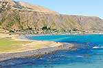
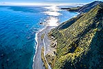
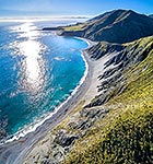
Wellington South Coast. Long Bay beach below, Tongue Point and Karori Rock light left, with South Island beyond over Cook Strait. West Wind turbine farm at right. Aerial panorama, Wellington South Coast, Wellington City District, Wellington Region, New Zealand (NZ), stock photo.
- Location:
- Wellington South Coast (other locations)
- District:
- Wellington City (see districts)
- Region:
- Wellington (see regions)
- Country:
- New Zealand (NZ)
- Notes:
- Large file (10134 x 3646 pixels native, no interpolation. | Ratio (height:width) 1:2.77
- Photographer:
- Rob Suisted
- Image #:
- 56440OP00
Keywords (advanced)
Related images


Similar images


Random images


")