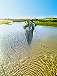
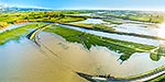
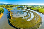
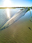
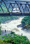
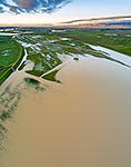
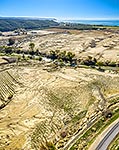
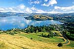
Flooding at Opiki. Manawatu River inundating surrounding farmland and State Highway 56 (SH56). Aerial view over flooded dairy pasture, looking north towards Palmerston North, Opiki, Horowhenua District, Manawatu-Wanganui Region, New Zealand (NZ), stock photo.
These images are protected by copyright, but we license them to suit your needs. Click
'quick quote' to learn more...
Flooding at Opiki. Manawatu River inundating surrounding farmland and State Highway 56 (SH56). Aerial view over flooded dairy pasture, looking north towards Palmerston North, Opiki, Horowhenua District, Manawatu-Wanganui Region, New Zealand (NZ) Stock Photo
Flooding at Opiki. Manawatu River inundating surrounding farmland and State Highway 56 (SH56). Aerial view over flooded dairy pasture, looking north towards Palmerston North, Opiki, Horowhenua District, Manawatu-Wanganui Region, New Zealand (NZ)
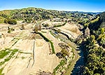
. Aerial view over flooded dairy pasture, looking north towards Palmerston North, Opiki, Horowhenua District, Manawatu-Wanganui Region, New Zealand (NZ) stock photo.")


. Aerial view over flooded dairy pasture, looking north towards Palmerston North, Opiki, Horowhenua District, Manawatu-Wanganui Region, New Zealand (NZ)")