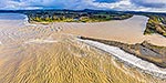
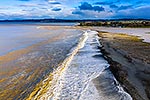
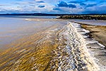
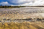
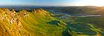
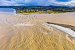
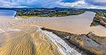
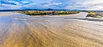
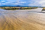
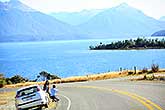
Tukituki River mouth and estuary, in flood after heavy rain. Town of Haumoana at left, Te Mata Peak centre. Aerial view, Clive, Hastings District, Hawke's Bay Region, New Zealand (NZ), stock photo.
These images are protected by copyright, but we license them to suit your needs. Click
'quick quote' to learn more...
Tukituki River mouth and estuary, in flood after heavy rain. Town of Haumoana at left, Te Mata Peak centre. Aerial view, Clive, Hastings District, Hawke's Bay Region, New Zealand (NZ) Stock Photo
Tukituki River mouth and estuary, in flood after heavy rain. Town of Haumoana at left, Te Mata Peak centre. Aerial view, Clive, Hastings District, Hawke's Bay Region, New Zealand (NZ)
 stock photo.")


")