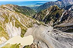
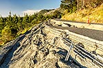
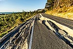
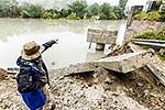
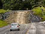
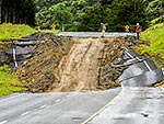
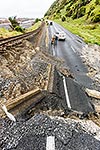
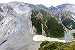
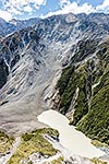
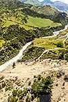
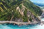
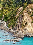
Kaikoura M7.8 earthquake damage from landslides covering State Highway 1 (SH1) and railway at Pinnacle Rock, as road clearing and water bombing of unstable slopes starts. Note geologists on hill top, Peketa, Kaikoura District, Canterbury Region, New Zealand (NZ), stock photo.
These images are protected by copyright, but we license them to suit your needs. Click
'quick quote' to learn more...
Kaikoura M7.8 earthquake damage from landslides covering State Highway 1 (SH1) and railway at Pinnacle Rock, as road clearing and water bombing of unstable slopes starts. Note geologists on hill top, Peketa, Kaikoura District, Canterbury Region, New Zealand (NZ) Stock Photo
Kaikoura M7.8 earthquake damage from landslides covering State Highway 1 (SH1) and railway at Pinnacle Rock, as road clearing and water bombing of unstable slopes starts. Note geologists on hill top, Peketa, Kaikoura District, Canterbury Region, New Zealand (NZ)
 and railway at Pinnacle Rock, as road clearing and water bombing of unstable slopes starts. Note geologists on hill top, Peketa, Kaikoura District, Canterbury Region, New Zealand (NZ) stock photo.")
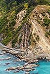


 and railway at Pinnacle Rock, as road clearing and water bombing of unstable slopes starts. Note geologists on hill top, Peketa, Kaikoura District, Canterbury Region, New Zealand (NZ)")