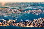
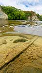
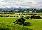
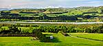
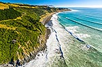
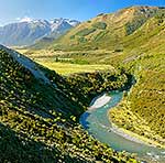
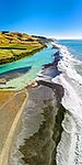
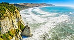
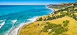
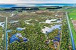
Hurunui River Mouth (left) to Gore Bay (right) coast with Point Gibson centre. Huruni River winding back past Domett to Amuri Plains behind. Aerial view, Cheviot, North Canterbury, Hurunui District, Canterbury Region, New Zealand (NZ), stock photo.
These images are protected by copyright, but we license them to suit your needs. Click
'quick quote' to learn more...
Hurunui River Mouth (left) to Gore Bay (right) coast with Point Gibson centre. Huruni River winding back past Domett to Amuri Plains behind. Aerial view, Cheviot, North Canterbury, Hurunui District, Canterbury Region, New Zealand (NZ) Stock Photo
Hurunui River Mouth (left) to Gore Bay (right) coast with Point Gibson centre. Huruni River winding back past Domett to Amuri Plains behind. Aerial view, Cheviot, North Canterbury, Hurunui District, Canterbury Region, New Zealand (NZ)
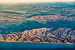
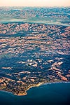
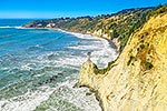
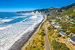
 to Gore Bay (right) coast with Point Gibson centre. Huruni River winding back past Domett to Amuri Plains behind. Aerial view, Cheviot, North Canterbury, Hurunui District, Canterbury Region, New Zealand (NZ) stock photo.")

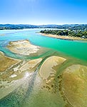

 to Gore Bay (right) coast with Point Gibson centre. Huruni River winding back past Domett to Amuri Plains behind. Aerial view, Cheviot, North Canterbury, Hurunui District, Canterbury Region, New Zealand (NZ)")