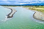
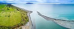
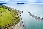
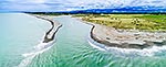
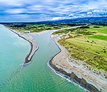
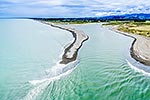
Otaki River mouth and estuary, with fishers on sandspit. Otaki farmland and Tararua Forest Park Ranges beyond. Aerial view, square format, Otaki Beach, Kapiti Coast District, Wellington Region, New Zealand (NZ), stock photo.
These images are protected by copyright, but we license them to suit your needs. Click
'quick quote' to learn more...
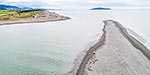
Otaki River mouth and estuary, with fishers on sandspit. Otaki farmland and Tararua Forest Park Ranges beyond. Aerial view, square format, Otaki Beach, Kapiti Coast District, Wellington Region, New Zealand (NZ) Stock Photo
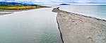
Otaki River mouth and estuary, with fishers on sandspit. Otaki farmland and Tararua Forest Park Ranges beyond. Aerial view, square format, Otaki Beach, Kapiti Coast District, Wellington Region, New Zealand (NZ)
 stock photo.")


")