
 stock photo.")
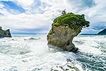
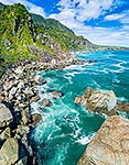
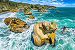
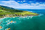
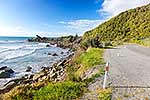
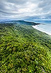
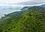
Paparoa National Park and Woodpecker Bay. Kaipataki Point, Fox River mouth and Seal Island distant right. Aerial view over Stewardship land parcel on cliff top, Paparoa, Buller District, West Coast Region, New Zealand (NZ), stock photo.
 EMAIL TO FRIEND
- Location:
- Paparoa (other locations)
- District:
- Buller (see districts)
- Region:
- West Coast (see regions)
- Country:
- New Zealand (NZ)
- Notes:
- Large file (8252 x 5712 pixels native, no interpolation). | Ratio (height:width) 1:1.44
- Photographer:
- Rob Suisted
- Image #:
- 63194FG00
Keywords (advanced)
Related images

Similar images
Random images

")