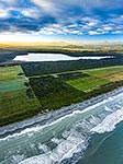
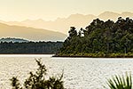
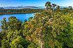
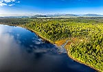
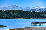
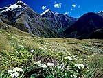
Lake Mahinapua. Aerial view looking over the Hokitika River plain, past Mt Camelback (569m, left) towards the Southern Alps, Hokitika, Westland District, West Coast Region, New Zealand (NZ), stock photo.
These images are protected by copyright, but we license them to suit your needs. Click
'quick quote' to learn more...
Lake Mahinapua. Aerial view looking over the Hokitika River plain, past Mt Camelback (569m, left) towards the Southern Alps, Hokitika, Westland District, West Coast Region, New Zealand (NZ) Stock Photo
Lake Mahinapua. Aerial view looking over the Hokitika River plain, past Mt Camelback (569m, left) towards the Southern Alps, Hokitika, Westland District, West Coast Region, New Zealand (NZ)
 towards the Southern Alps, Hokitika, Westland District, West Coast Region, New Zealand (NZ) stock photo.")
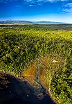
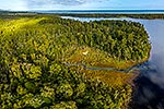
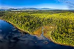


 towards the Southern Alps, Hokitika, Westland District, West Coast Region, New Zealand (NZ)")