
 stock photo.")
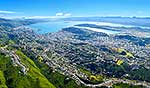
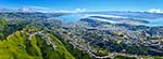
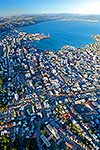
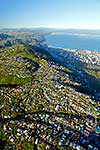
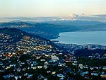
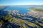
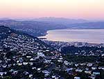
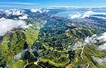
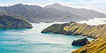
Wellington City aerial view. Brooklyn suburb left, City and Harbour centre left, Airport right. Earthquake faultline visible along left of harbour, Tararua ranges distant. Panorama, Wellington City, Wellington City District, Wellington Region, New Zealand (NZ), stock photo.
- Location:
- Wellington City (other locations)
- District:
- Wellington City (see districts)
- Region:
- Wellington (see regions)
- Country:
- New Zealand (NZ)
- Notes:
- Large digital file (9247 x 4555 pixels native, no interpolation) | Ratio (height:width) 1:2.03
- Photographer:
- Rob Suisted
- Image #:
- 44963TC00
Keywords (advanced)
Related images


Similar images
Random images


")