
 stock photo.")
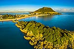
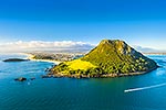
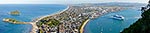
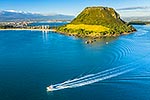
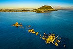
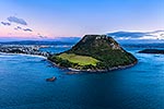
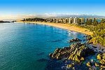
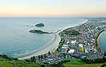
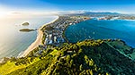
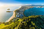
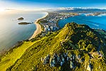
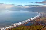
Mount Maunganui Beach and Mt Mauao, at Tauranga Harbour Entrance. 231m high lava dome above Mt Maunganui Beach. Moturiki and Motuotau Islands left. Aerial view, Mount Maunganui, Tauranga District, Bay of Plenty Region, New Zealand (NZ), stock photo.
 EMAIL TO FRIEND
- Location:
- Mount Maunganui (other locations)
- District:
- Tauranga (see districts)
- Region:
- Bay of Plenty (see regions)
- Country:
- New Zealand (NZ)
- Notes:
- Very large file (9874 x 5992 pixels native, no interpolation). | Ratio (height:width) 1:1.64
- Photographer:
- Rob Suisted
- Image #:
- 61097OP00
Keywords (advanced)
Related images
Similar images
Random images


")