
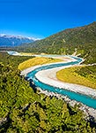
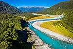
 at left. Aerial view, Whataroa, Westland District, West Coast Region, New Zealand (NZ) stock photo.")
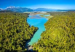
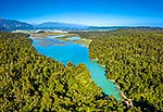
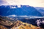
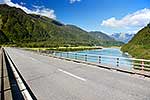
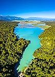
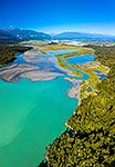
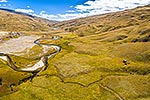
Lake Rotokino, coloured by the glacial fed water of the Whataroa River, drained by the Rotokino River. Mt Adams (2208m) at left. Aerial view, Whataroa, Westland District, West Coast Region, New Zealand (NZ), stock photo.
 EMAIL TO FRIEND
- Location:
- Whataroa (other locations)
- District:
- Westland (see districts)
- Region:
- West Coast (see regions)
- Country:
- New Zealand (NZ)
- Notes:
- Very large file (9020 x 6201 pixels native, no interpolation). | Ratio (height:width) 1:1.45
- Photographer:
- Rob Suisted
- Image #:
- 63265FL00
Keywords (advanced)
Related images
Similar images
Random images
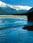

 at left. Aerial view, Whataroa, Westland District, West Coast Region, New Zealand (NZ)")