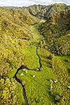
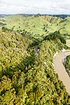
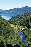
Native forest and farmland. Waitara River and Otaraoa Road. Aerial view ove canopy, Tarata, New Plymouth District, Taranaki Region, New Zealand (NZ), stock photo.
These images are protected by copyright, but we license them to suit your needs. Click
'quick quote' to learn more...
Native forest and farmland. Waitara River and Otaraoa Road. Aerial view ove canopy, Tarata, New Plymouth District, Taranaki Region, New Zealand (NZ) Stock Photo
 stock photo.")


")