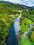
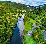
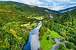
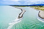
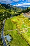
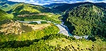
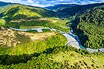
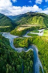
Otaki Forks. Looking up the Waiotauru River valley towards Maymourn Junction. Otaki River bottom left, across from the Otaki Forks Road. Tararua Forest Park. Aerial view, Otaki Forks, Kapiti Coast District, Wellington Region, New Zealand (NZ), stock photo.
These images are protected by copyright, but we license them to suit your needs. Click
'quick quote' to learn more...
Otaki Forks. Looking up the Waiotauru River valley towards Maymourn Junction. Otaki River bottom left, across from the Otaki Forks Road. Tararua Forest Park. Aerial view, Otaki Forks, Kapiti Coast District, Wellington Region, New Zealand (NZ) Stock Photo
Otaki Forks. Looking up the Waiotauru River valley towards Maymourn Junction. Otaki River bottom left, across from the Otaki Forks Road. Tararua Forest Park. Aerial view, Otaki Forks, Kapiti Coast District, Wellington Region, New Zealand (NZ)
 stock photo.")


")