
 stock photo.")
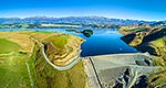
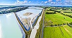
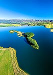
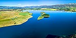
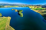
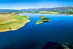
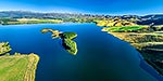
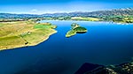
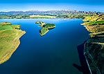
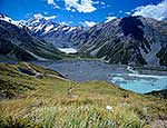
Lake Opuha and island, a man made lake for irrigation and power generation, with Sherwood Range beyond lush green farmland around Ashwick Flat. Aerial panorama, Fairlie, MacKenzie District, Canterbury Region, New Zealand (NZ), stock photo.
 EMAIL TO FRIEND
- Location:
- Fairlie (other locations)
- District:
- MacKenzie (see districts)
- Region:
- Canterbury (see regions)
- Country:
- New Zealand (NZ)
- Notes:
- Very large file (11909 x 7113 pixels native, no interpolation). | Ratio (height:width) 1:1.67
- Photographer:
- Rob Suisted
- Image #:
- 59093FL00
Keywords (advanced)
Related images
Similar images
Random images


")